GeoPrecision Labs StarCORS

Centimeter positioning you own, on infrastructure you control.

StarCORS is a complete GNSS correction network: reference stations, correction server, private radio and rovers, installed and run inside your own perimeter. No cloud, no subscription, and no position data leaving your network. Designed and built in the UAE.

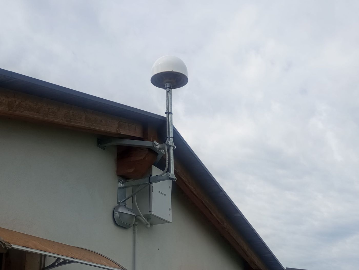
StarCORS reference station: choke ring GNSS antenna on a mast with its equipment enclosure, mounted on a building
A StarCORS reference station in operation.
5 mm + 0.5 ppmNetwork RTK accuracy
Up to 300 kmreliable beyond the station network
Your serversCorrections computed on your premises
One-time purchaseNo per-rover subscription

Your correction requests are sensitive data

Most centimeter positioning runs on cloud correction services. To get a network RTK correction, each rover sends its position to the provider, every second. Over time that becomes a full record of where your vessels, vehicles and machines operate, held by a third party, often abroad.

Cloud correction service

Per-rover subscription. The service stops when payments stop.

StarCORS

Owned by you. Broadcast is the standard setup, so rovers only receive.

How StarCORS works

Every part of the chain sits inside your perimeter. Nothing depends on the public Internet or on an outside provider.

Reference stations observe

Permanent GNSS stations with choke ring antennas track GPS, Galileo, GLONASS and BeiDou around the clock.

Your server computes

The StarCORS correction server on your premises turns station data into corrections and checks every station’s health.

Private links deliver

A dedicated UHF radio network carries corrections to the field. Your own fiber or IP network can be used as well.

Rovers position

Rovers on vessels, vehicles and machines compute centimeter positions, inside the station network and well beyond it.

Broadcast (standard)

Corrections are broadcast one way, once per second. Rovers only receive and never transmit, so their position is never disclosed.

VRS over two-way UHF

For millimeter-level network RTK. The rover reports its position, but only to your own server.

Fewer stations, far wider coverage

Competing VRS services work only inside the polygon formed by their reference stations. StarCORS works inside it and far outside it, including at sea.

StarCORS coverage compared with a conventional VRS service Four reference stations form a polygon. Conventional VRS services work only inside it. StarCORS works inside the polygon and reliably up to about 300 km outside it, with a maximum of about 800 km. Station polygon ≈ 80 km spacing Reliable to ≈ 300 km outside Maximum ≈ 800 km Vessel offshore
Reference stationWhere VRS services workWhere StarCORS also works
Schematic, not to scale.
  • 4 stationscover a large part of the UAE, including its waters.
  • 8 stationsgive complete national coverage.
  • Island stationsextend coverage across the Gulf.
  • ≈ 80 km spacingfor best accuracy inside the network; precision improves as stations are added.
  • Offshore precisionwithout placing stations near the work area.
Correction performance by method
MethodAccuracy, planAccuracy, heightFix timeCoverageRover link
Network RTK (VRS)5 mm + 0.5 ppm6 mm + 0.5 ppmA few secondsRegionalTwo-way UHF
SSR2OSR8 mm + 0.5 ppm10 mm + 0.5 ppmTens of secondsRegionalBroadcast
PPP-RTK2.5 cm2.0 cmTens of seconds*RegionalBroadcast
PPP-AR2.5 cm2.0 cm5–15 minutesExtended regional or globalBroadcast

* Depends on the distance to the station network. GPS, Galileo, GLONASS and BeiDou, with RTCM v3 output.

Independently validated by the University of Bologna

Testing showed accuracy, convergence time, availability and reliability comparable to leading commercial solutions, and better in selected scenarios. Full results are available on request.

One integrated system

Hardware, software and radio from one team, designed to work together and delivered under your own brand if you wish.

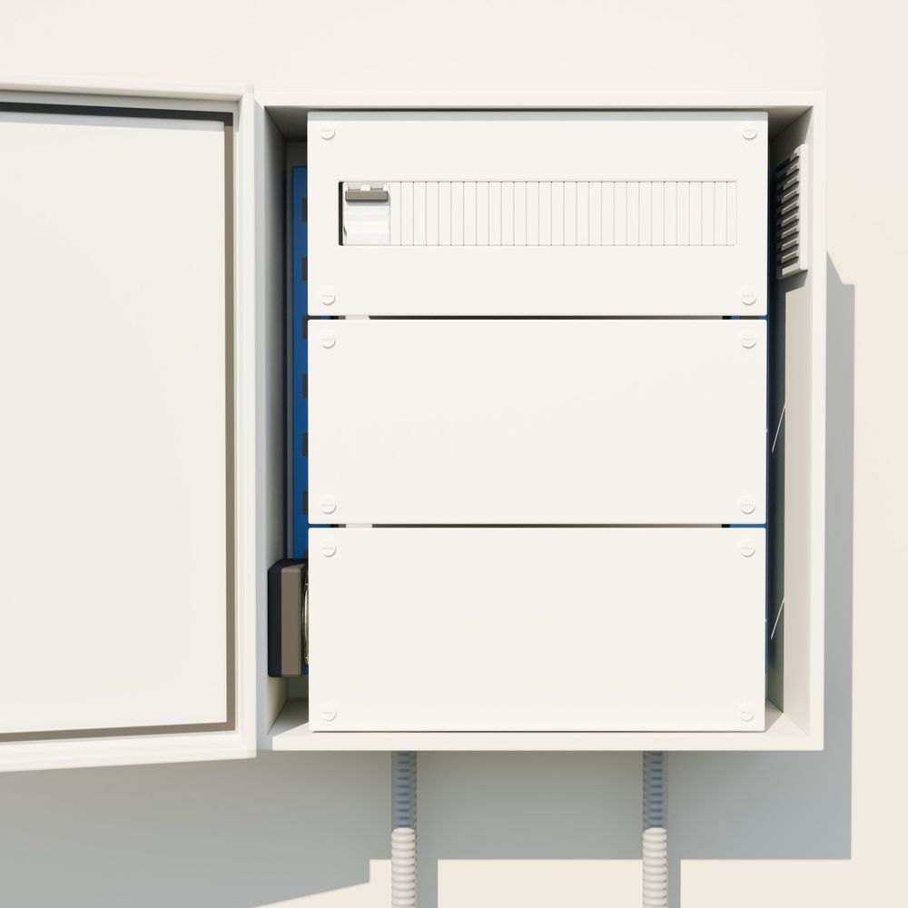
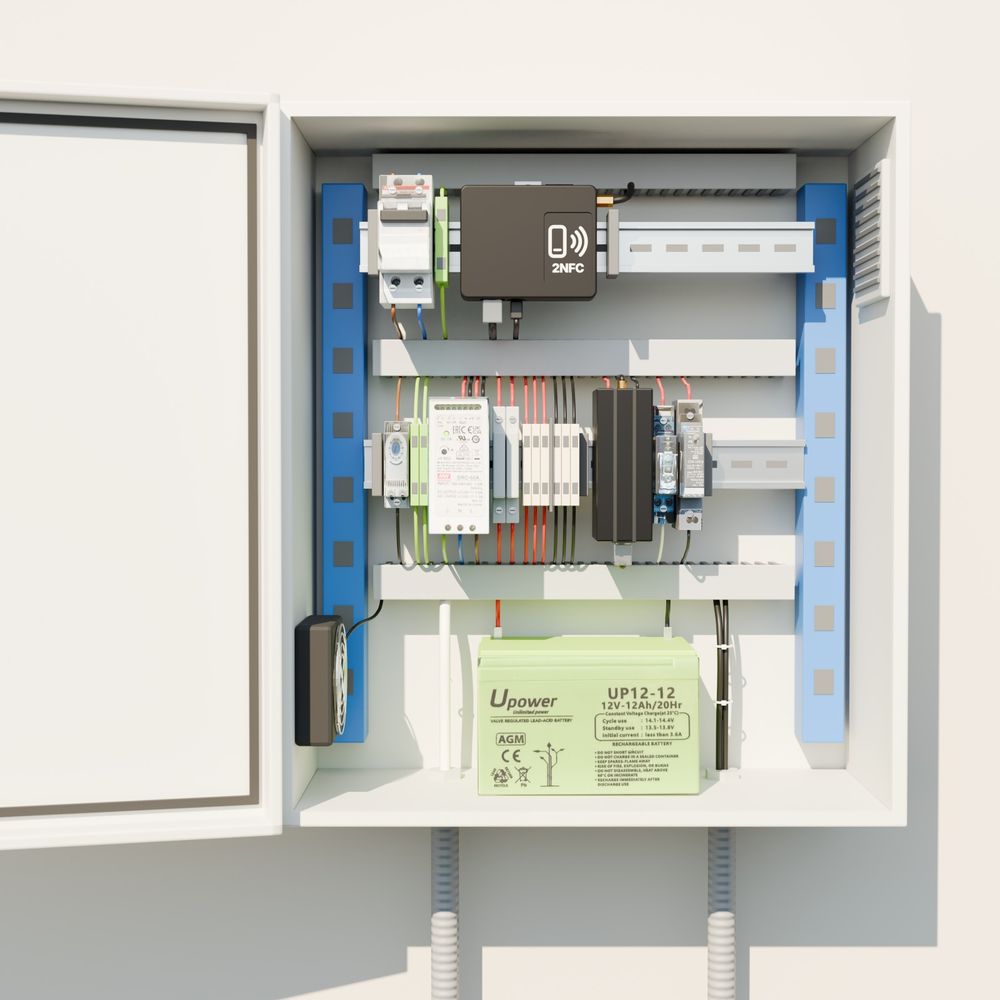
StarCORS reference base station enclosure, closed StarCORS reference base station enclosure, open, showing receiver, power and backup battery

Reference base station

A rugged, complete station for permanent installations, geodesy and structural monitoring, built for 24/7 operation.

  • Multi-constellation, multi-frequency GNSS reception
  • Industrial components in an IP66 / IK10 enclosure, with backup battery
  • Connects over UHF, fiber or Ethernet; LTE only where you allow it
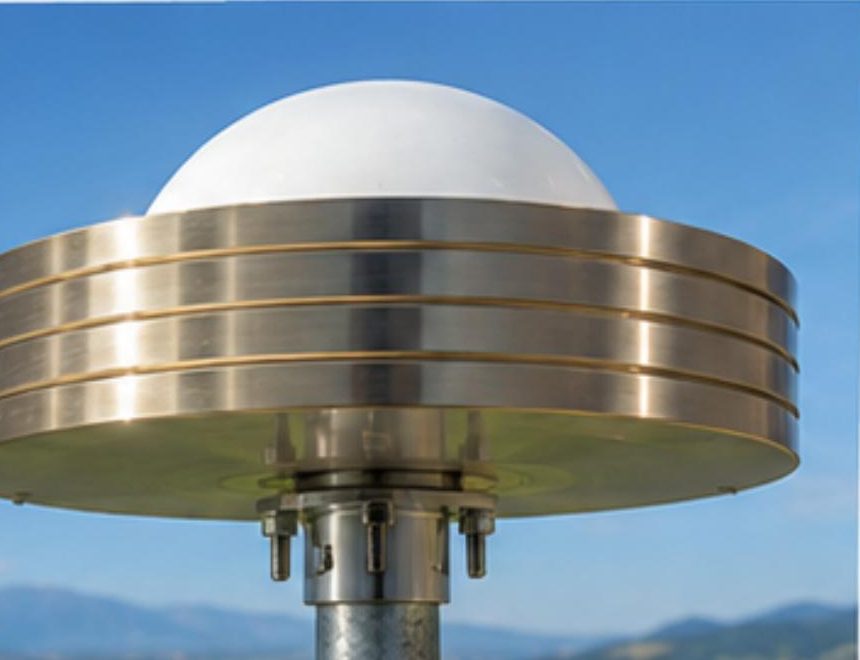
3D choke ring GNSS antenna with the radome removed

3D choke ring antenna

Suppresses multipath for a stable phase center, the foundation of network accuracy.

Phase center
± 1 mm
Signals
GPS, GLONASS, Galileo, BeiDou, QZSS, NavIC, L-band, SBAS
Calibration
NOAA calibration file
Protection
IP67, −40 to +85 °C
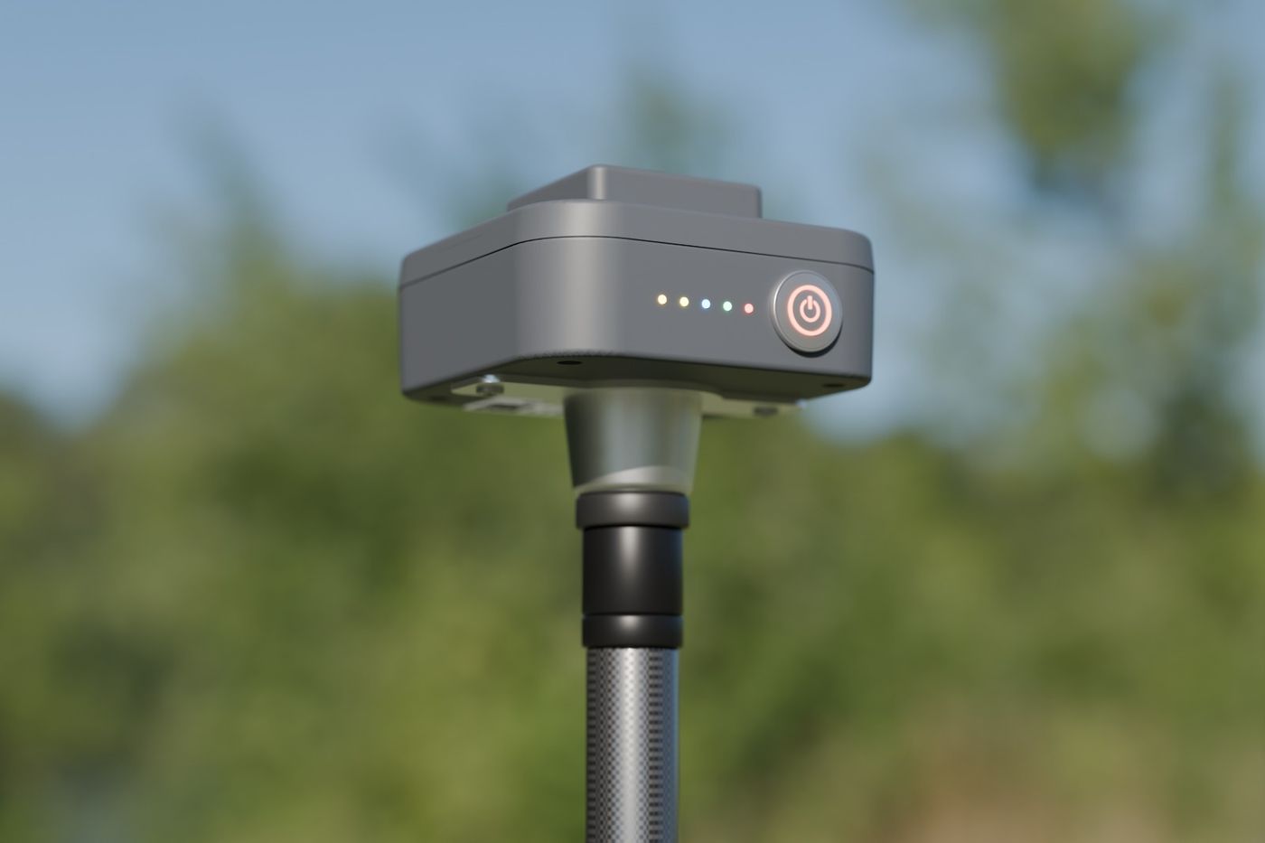
Compact GNSS rover receiver on a carbon survey pole

Rovers built to your requirements

Configured from basic to advanced for each application: survey, machines, vehicles or vessels.

Example
MS2 rover
RTK accuracy
1 cm + 1 ppm
Channels
184, up to 20 Hz
Working time
Up to 15 hours, IP65
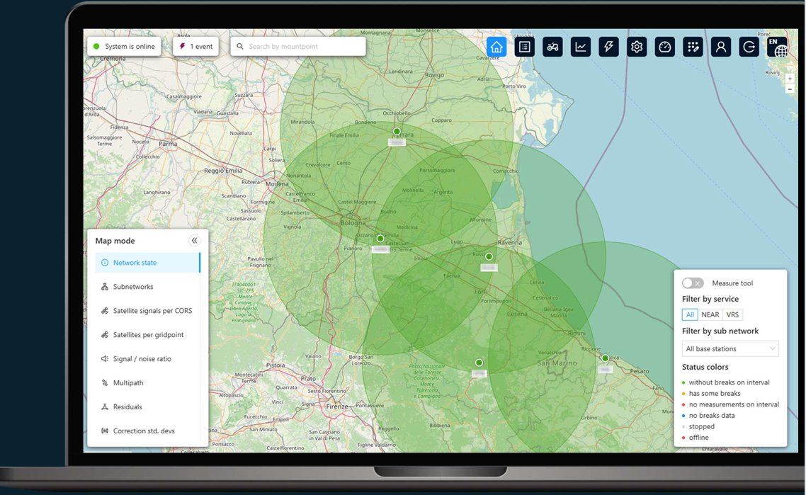
StarCORS network software showing station coverage on a map

Network software

Computes corrections and manages the whole network from your own servers, on-premise or in private infrastructure.

  • Nearest base station, network RTK (VRS), PPP-AR and PPP-RTK
  • Receiver-agnostic for stations and rovers, with multiple RTCM v3 outputs
  • Continuous monitoring of every station: delays, signal quality, multipath
  • Hundreds of stations in one installation; web interface with geofencing

Private radio network

A dedicated UHF network replaces the Internet. It is built with mission-critical SATEL radio components, assembled in the UAE, with encrypted links. Relay stations every 20–50 km extend the data link where needed.

The same radio technology carries GNSS corrections across the Panama Canal.

Deformation monitoring, built in

StarCORS continuously measures the baselines between its own stations, with thresholds as low as 1–2 cm. When a baseline changes, an alert is raised in StarCORS or in your existing monitoring tools.

Your positioning network doubles as an early warning for ground and structural movement, with no extra infrastructure.

Private by design, trusted under attack

Security is a property of the whole system, not an external service you depend on.

  • Complete infrastructure ownership
  • No public Internet required
  • No position data sent to outside providers
  • Dedicated fiber support
  • Encrypted radio links
  • Air-gapped operation
Patent-pending anti-spoofing technology

Atomic clock reference

Rubidium clocks in stations and high-end rovers give an independent, ultra-stable time scale. Attempts to shift satellite signals show up as sharp jumps and are caught.

Trusted ephemeris delivery

The network sends a verified set of satellite orbit data over a secure side channel. Rovers compare it with what the satellites broadcast and raise an alert on any mismatch.

Station integrity filtering

Each station knows its exact coordinates, so it knows what it should measure. Outliers are flagged before corrections are generated, so manipulated data never reaches rovers.

Own the capability instead of renting it

StarCORS is a one-time purchase, sized by service area and number of rovers. The annual fee covers support and updates only. The network keeps running without it.

AspectCloud subscription servicesStarCORS
Where corrections are computedOn the provider’s cloud serversOn your own premises
Your rovers’ positionsSent to the provider with every requestNever sent to a third party
Internet dependencyRequired, usually over LTENone: private radio or your own fiber
Commercial modelRecurring per-rover subscriptionOne-time purchase; optional support fee
If payments stopThe service stopsThe network keeps running
Working areaInside the station polygon onlyInside the polygon and up to ≈ 300 km beyond it
BrandingThe provider’s brand and serviceFully white-label, fully yours

Positioning when GNSS is denied

Jamming and spoofing can take satellite positioning away. We are developing a terrestrial positioning layer in the UAE: ground transmitters at known positions create a local radio-navigation field, and integrated rovers combine it with GNSS and other sensors.

Both deployment concepts are developed and mathematically validated. Partners who co-invest get a capability designed around their own ports, facilities and sea areas, and the first pilot deployment.

Discuss an R&D partnership

Local mode

Guaranteed positioning inside a protected zone, such as a port, base or facility.

Global mode

Wide-area coverage across land and sea.

Designed, built and supported in the UAE

GeoPrecision Labs is a Dubai-based deep-technology company building sovereign high-precision positioning infrastructure for governments, defense organizations, critical industries and enterprises.

We are a spin-off of Innovation Floor (Ardhiyat Al Ibdaa Information Solutions), with more than a decade of scientific computing and advanced engineering behind us.

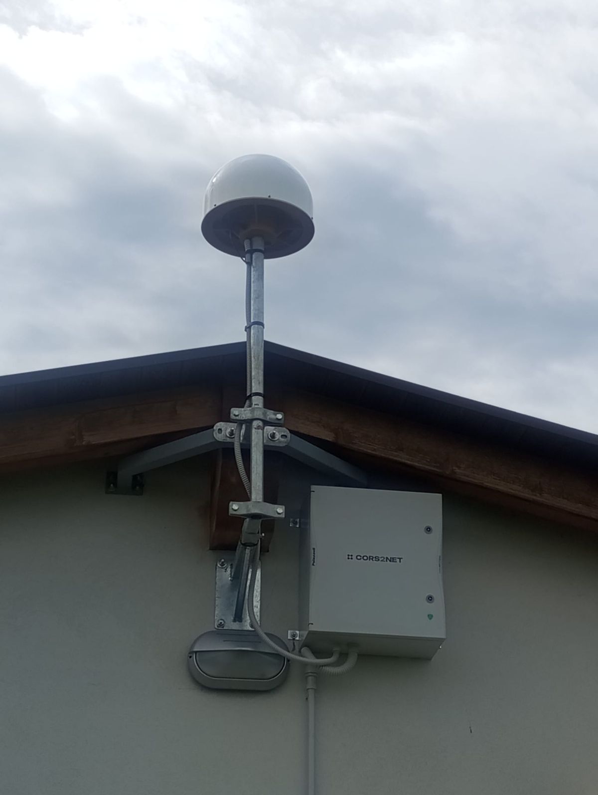
StarCORS reference antenna and enclosure mounted at the edge of a roof

One team, accountable for the full lifecycle:

  • Network design and coverage planning
  • Manufacturing and assembly
  • Installation and commissioning
  • Calibration and validation surveys
  • Operator training
  • Service level agreements
  • Field maintenance
  • Emergency response support
HardwareRovers, base stations, antennas and enclosures built by our team in the UAE.
SoftwareCorrection engine, server, network management and anti-spoofing developed in the UAE.
RadioSATEL components from Finland, assembled and integrated in the UAE.

Start with a technical workshop

Tell us about your sites, your accuracy needs and your security constraints. We will come back with a coverage plan for your land and sea areas.

Email info@geoprecisionlabs.com